3d Data
Advertisement
KeyShot 64-bit v.3.3
KeyShot 64-bit is an entirely CPU based standalone 3D rendering and animation system for 3D data.
Advertisement
Autodesk DWF Writer v.4.0.0.42
DWF publishing helps you enhance collaboration and easily exchange project information with extended teams. Download the free* Autodesk® DWF™ Writer to securely share 2D and 3D data as DWF files-no matter what design application you're using.
Pepakura Viewer v.3.0.4
Pepakura Viewer is a dedicated tool that opens files created with Pepakura Designer, an application to design paper craft models from 3D data.
RCP Transformer v.3.2.0.12
RCP 3D Transformer is a powerful tool enabling to visualize the 3D files and to generate transformation processes of 3D data in order to convert them in a large number of formats.
Jinx v.1.8
Jinx can help you to analyze 3D data sets, is for 3D electron microscopic data sets produced using electron tomography, but may be used for any aligned 3d data set.Jinx contains the facility for annotating 3D microscopic data using formal ontologies.
ViewShape v.0.1.8.2912 Beta
ViewShape is a free 3D Viewer which has a set of usable features that will come in convenient for 3D modelers or other folks that work with 3D data-sets, especially big ones. And we're just getting started.
VRML smoother v.1.0
View your VRML files with this tool. VRML smoother works with 3D data saved in VRML format. It enables to smooth (to refine,
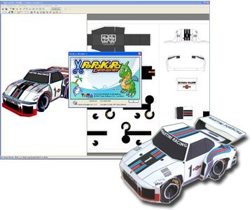
Pepakura Designer 3.1.0a v.1.0
Pepakura Designer allows you to create paper craft models from 3D data.
ImageDIG 2D/3D Image Digitizer v.2.0
This software consists of three integrated modules that allow you to convert 2D flat images into 3D (x, y, z) data or convert graphs in image form into 2D numerical data.
FloorPlan 3D V.9 v.9.0.130
FloorPlan 3D is a 3D design software for designing houses. It has many features. It gives a an interface that is easier to understand, but not to use! Site information, the position of sun, etc can be added.
CARIS Easy View v.2.0.0.1
View your spatial data from a wide range of file types, connect to a WMS server, load ENCs and VPF libraries, visualize BASE, BAG or LOTS grids in interactive 3D, export 3D flight paths to XML or to an AVI digital video file.